Chapter 4. Wasan as a Practical Science
コラム Survey Instruments and Companion Set (Level 0)
In surveys, various instruments have been used. The instruments used and their names depend on the period and survey school. Here, we would like to introduce some such instruments with an emphasis on those displayed in this exhibition.
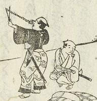
When directly measuring a comparatively short distance, people used poles and ropes marked with scales. They had to be careful due to the fact that ropes expanded and contracted due to humidity.
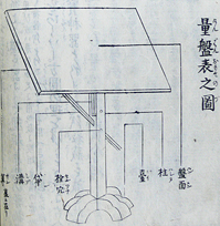
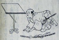
Plane table (Kenban) used in survey by Komoryu. They indirectly measured an object by drawing a geometric figure similar to it with rulers and compasses.
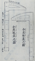
Ruler to be used for drawing. This is a Bundo no kane (protractor iron frame) making up a set with its protractor.
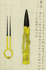
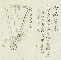
Compass. Open its legs and put them on the ends of a section to measure the length, and one can compare the section with another in terms of length. When one dips the groove of the tip of one leg in ink, one can attach a mark or draw a circle.
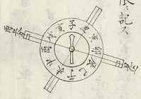
A direction was measured with an instrument using magnets. The directions were represented by the twelve horary signs; and instruments with 120 ticks were made by dividing each horary sign into 10 equal subdivisions, and later instruments equivalent to their western counterparts with 360 ticks were made (which were useful when using a trigonometric table).
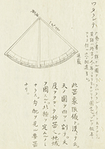
The quadrants, also used by Ino Tadataka, are instruments used to measure altitudes. They were used to measure latitudes in astronomical observations and navigation in the West, and were also used in surveying in Japan. Astrolabes were first used in Greece in ancient times. Sextants and octants could be used for more accurate measurement, and they were used for coastal defense, including for the cartography of coasts and gunnery.
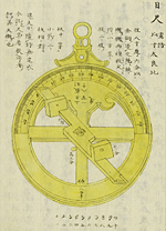
Astrolabe (Isutarahi)
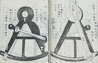
Sextant